
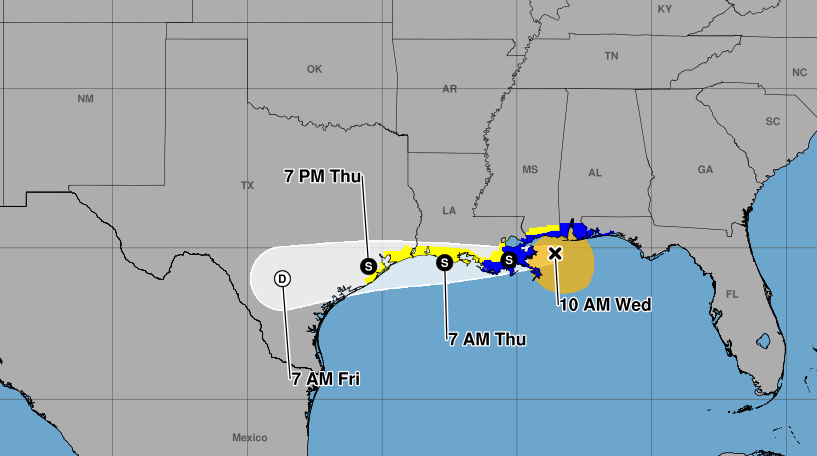
Tropical Storm Bertha has continued to move toward the Louisiana and upper Texas coasts Wednesday morning. Bertha is expected to make landfall sometime Wednesday afternoon or evening.
At 10 a.m., Bertha was located near latitude 29.8 North and longitude 88.6 West, moving west-northwest at 6 mph. Maximum sustained winds had decreased to 50 mph. The storm is forecast to move near or along the Louisiana and upper Texas coasts through Thursday before moving inland over Texas Friday.
A Tropical Storm Warning remains in effect from the Okaloosa-Walton county line in Florida to Morgan City, including metropolitan New Orleans and Lake Pontchartrain. A Tropical Storm Watch is in effect west of Morgan City to Sargent, Texas, and for Lake Maurepas.
Storm surge of 1 to 3 feet is possible from Port Bolivar, Texas, to the mouth of the Mississippi River and in Lake Pontchartrain. Bertha could produce 1 to 4 inches of rain, with isolated amounts up to 6 inches, raising the risk of flash flooding through Friday.