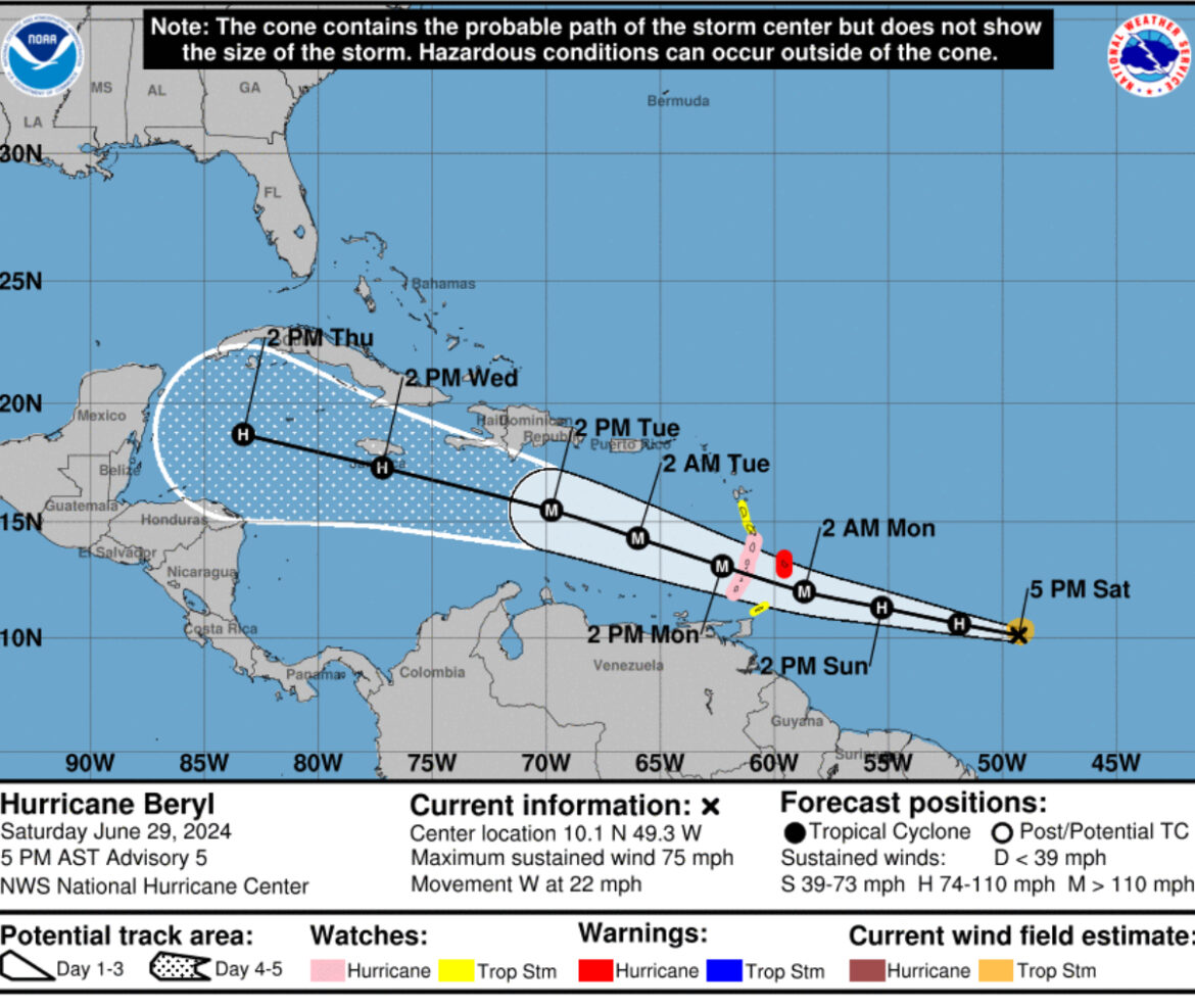
(NWS) What was Tropical Storm Beryl continues to rapidly strengthen, and has now become the hurricane of the 2024 season. Satellite images show an expanding central dense overcast feature, and recent microwave images indicate that a partial eyewall has formed. Beryl is a compact tropical cyclone, with its tropical-storm-force winds estimated to extend up to 50 n mi from the center. Both the NOAA and Air Force Reserve Hurricane Hunters are scheduled to investigate Beryl on Sunday, and the data they collect will be very helpful in assessing the system’s structure and intensity.
Beryl continues to wobble around, but the general motion has been westward at a quick 19 kt. A strong subtropical ridge should keep the hurricane moving generally westward at only a slightly slower forward speed for the next couple of days. This motion should take Beryl across the Windward Islands late Sunday night and Monday. A weakness in the ridge could cause Beryl to gain a little more latitude during the early and middle portions of next week, before turning back slightly to the left as another ridge builds to the northwest of Beryl. The NHC track forecast is very similar to the previous one and in fairly good agreement with the various consensus models.
Now that Beryl has developed a compact inner core, it seems likely that it will continue to intensify quickly since the hurricane will remain in near ideal environmental conditions during the next day or two. The NHC intensity forecast is again nudged upward in the short term, and shows Beryl becoming a dangerous major hurricane prior to it reaching the Windward Islands. Beyond a couple of days, when Beryl is moving across the Caribbean, an increase in shear should end the strengthening trend and induce some weakening toward the end of the forecast period. The intensity models are coming into better agreement on this scenario, and the NHC forecast is roughly near the middle of the guidance envelope.
Key Messages:
1. Beryl is expected to be a dangerous major hurricane when it reaches the Windward Islands late Sunday night or Monday bringing destructive hurricane-force winds and life-threatening storm surge. Hurricane Watch and Warnings are in effect for much of the Windward Islands.
2. Heavy rainfall and localized flooding is expected across the Windward Islands Sunday night and Monday.
3. Interests in the central and western Caribbean should monitor the progress of this system. Users are reminded that there is large uncertainty at days 4 and 5 and to not focus on the specific details of the track or intensity forecast.


