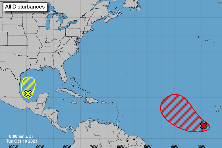
In the southwestern Gulf of Mexico, an area of low pressure is showing a modest increase in showers and thunderstorms. Although environmental conditions are only slightly favorable, surface pressures near the system have been dropping. This gives it a small chance for development over the next day or two. However, come Wednesday morning, it’s expected to merge with a growing frontal system in the western Gulf.
An Air Force Reserve Reconnaissance aircraft may be deployed today to examine the system further. Regardless of whether it develops into a tropical cyclone, gale-force winds are predicted for parts of the northern Gulf by Wednesday. The Gulf Coast could also see heavy rainfall later this week. For additional information and updates, refer to your local National Weather Service office and their high seas forecasts. The chances of formation through 48 hours and seven days are both at 30 percent.


